History of the lake
Named by a missionary's companions in 1851, raised by coal money in the 1900s and returned to the public in 2001.
- Before 1851
Two natural lakes
The basin held two separate natural lakes, fed by Shell Creek and runoff. Early on the water was salty enough to support little life. [Source, 2]
- 1851
De Smet’s companions name it
Traveling to the Horse Creek treaty council in late August 1851, Jesuit missionary Pierre-Jean De Smet came to "a lovely little lake about six miles long," and his traveling companions named it for him. [Source, 2]
- 1865
Powder River Expedition
The Army’s Powder River Expedition passed the lake. A stretch of Bozeman Trail ruts about a mile west of it is on the National Register of Historic Places, on private land. [Source, 2]
- 1907 to 1921
Becoming a reservoir
Water rights to divert Piney Creek date to 1907. An inlet and dam in 1919 raised the lake 22 feet, and the earth-fill dam was built in 1921. [Source]
- 1940
The monument
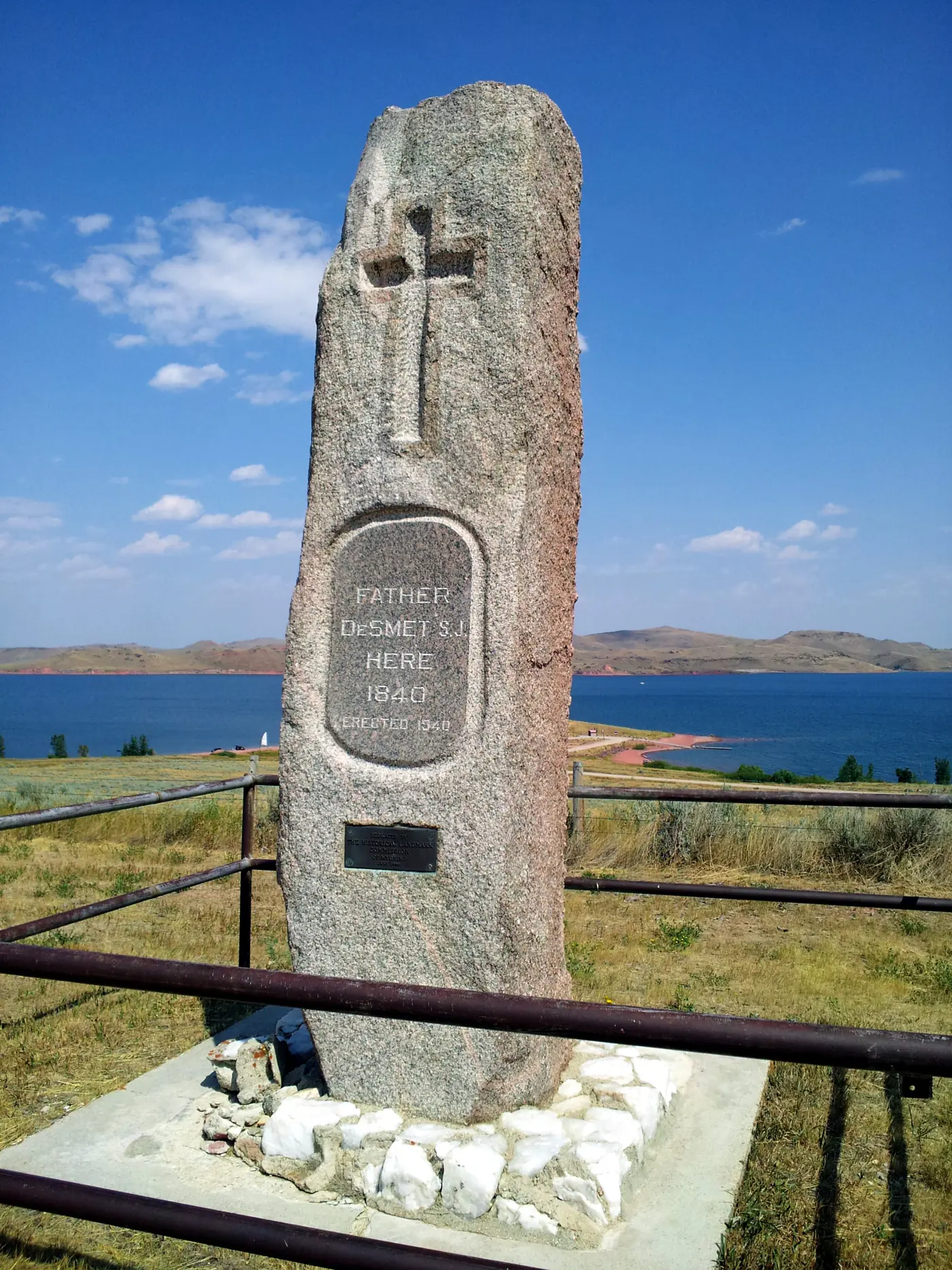
A stone monument to Father De Smet went up at the lake. It says 1840. The naming was 1851. [Source]
- 1958 to 1976
Coal money
Reynolds Mining raised the lake 32 feet in 1958 and 7 more in 1972. Texaco bought the property in 1976, planning to use the water for a coal project tied to what it called the world’s largest low-grade coal deposit. Texaco raised the lake another 40 feet. The plant was never built. [Source, 2]
- 2001 to 2016
Back to the public
The lake was deeded to local counties in 2001. Johnson County formed its Lake DeSmet Operating Department in 2013, and in 2016 Game and Fish announced a 99-year lease on 66,024 acre-feet that guarantees public access to the high-water mark. [Source, 2, 3]
Why the shore is red
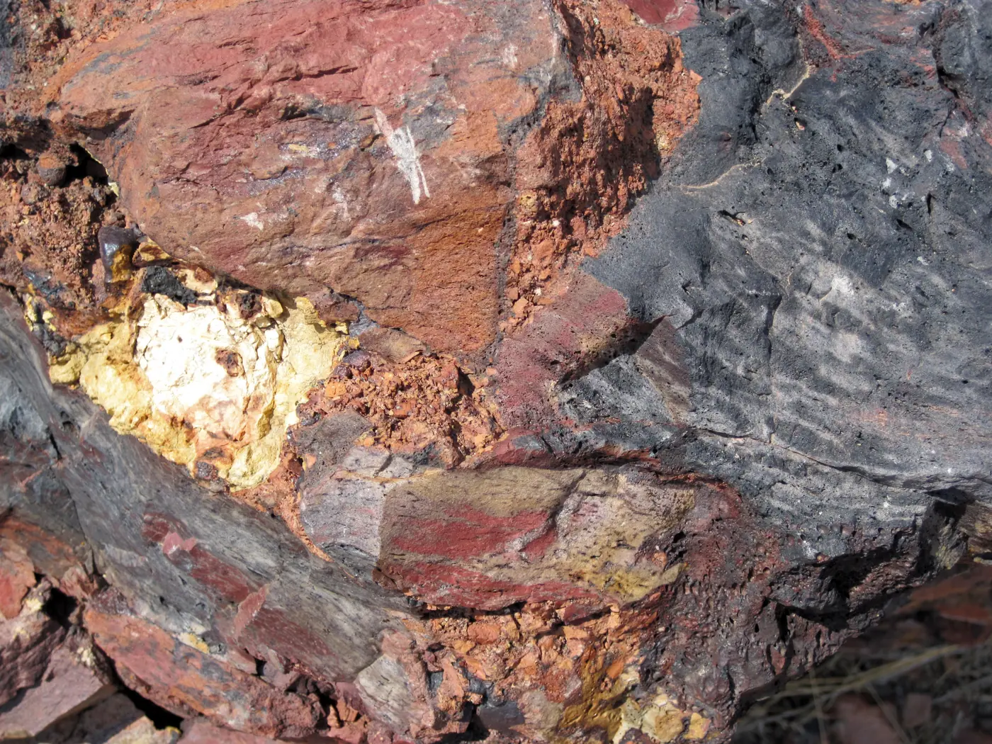

The hills and beaches around Lake DeSmet are full of clinker, sometimes called scoria: shale and sandstone baked hard and red when the coal seam under them caught fire and burned. The USGS describes the lake as sitting in a depression formed by the natural burning of the Lake DeSmet coal zone. [USGS] The coal under the area drew enough attention that the USGS published a whole bulletin on the Buffalo-Lake DeSmet coal field in 1959. [USGS Bulletin 1078]
That same broken red rock is why the lake is not filled to the top: the state water plan notes water seeps out through the scoria hills on the north side. [State Water Plan]
Under the water
Raising the dam put Seney Point under water. Locals say an old swimming pool there can still be seen on clear days. [Cowboy State Daily]
See it for yourself
- The De Smet monument stands near the lake; WyoHistory.org has a field-trip guide. [WyoHistory.org]
- Fort Phil Kearny, the Fetterman Fight and the Wagon Box Fight sites are a short drive north. See nearby.
- And then there is Smetty.
The lake, four times a year
Ice-on and ice-off notes, what Game and Fish is saying about the fishery, events worth the drive and new places to stay. One email a season.