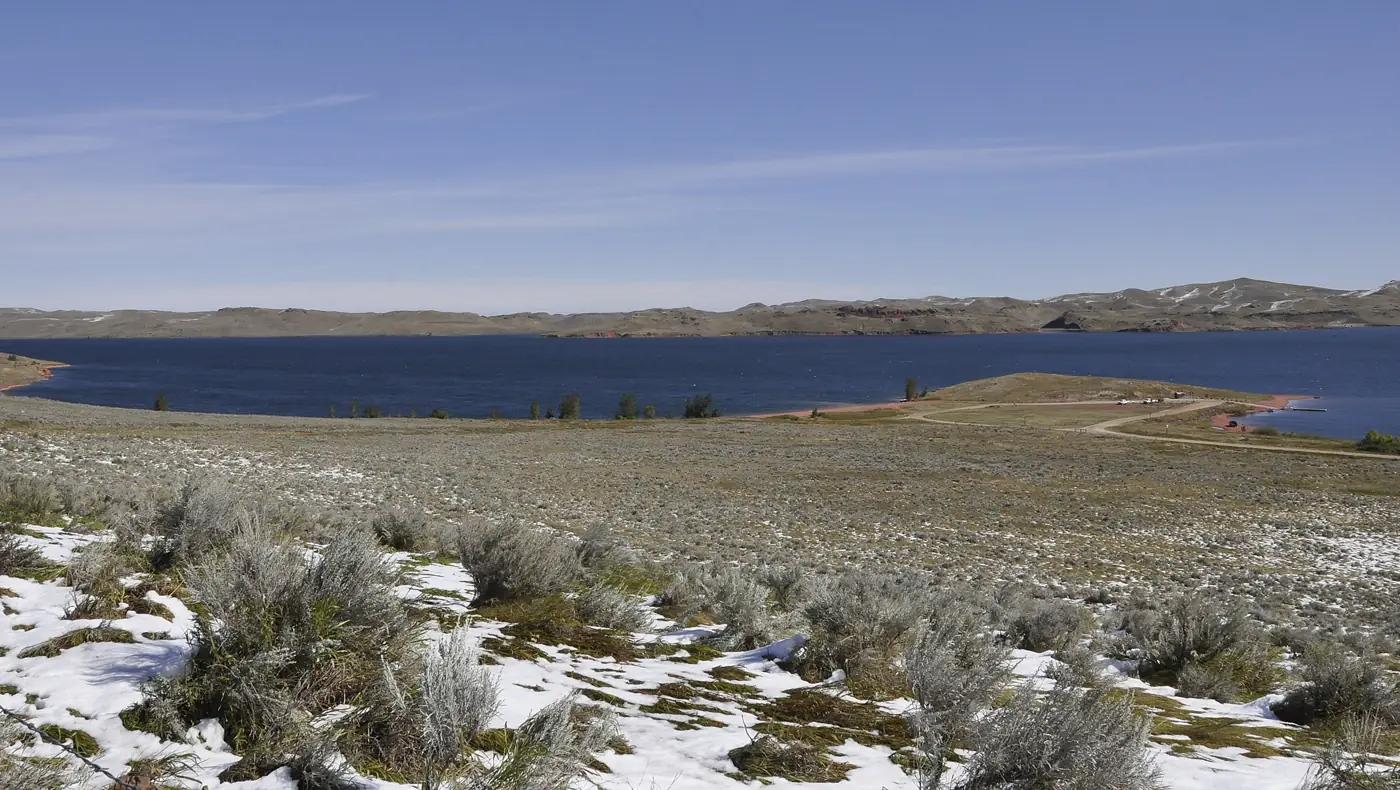
Lake DeSmet, Wyoming
A high-plains reservoir in Johnson County, about 8 miles north of Buffalo at I-90 Exit 51. If you were looking for De Smet, South Dakota, you are more than 400 miles too far west.
The short version
Lake DeSmet is a reservoir of about 3,400 surface acres, up to 120 feet deep, sitting in rolling sage and red clinker hills between Buffalo and Sheridan. [Game and Fish, 2] Game and Fish counted about 35,000 anglers a year catching around 60,000 trout in its 2016 report. [Game and Fish, 2016]
People come for trout, ice fishing, cheap first-come camping on the south shore and a monster story that has been told here for more than a century. They stay in Buffalo, Story, Banner or Sheridan, or at the handful of places right on the water. See where to stay.
By the numbers
| Measure | Value | Source |
|---|---|---|
| Surface area | About 3,400 acres (Game and Fish). Other official figures run from about 3,000 to almost 3,600 depending on water level. | [WGFD, 2, 3] |
| Maximum depth | 120 feet | [Johnson County] |
| Average depth | 69 feet | [WGFD] |
| Capacity | 234,987 acre-feet | [Johnson County] |
| Surface elevation | About 4,570 feet | [Wikipedia] |
| Coordinates | 44.4662, -106.7383 | [Wikipedia] |
| Water level pattern | Dive notes say usually deepest in May, lowest in October | [PADI] |
Getting here
- From Buffalo: about 8 miles north on I-90 to Exit 51. [Johnson County]
- From Sheridan: about 26 miles south on I-90, measured between exit mileposts. [I-90 exit list]
- From Billings: about 165 miles to Buffalo, a few miles less to the lake. [Wanderlog]
- Flying: Sheridan (SHR), Casper (CPR) and Gillette (GCC) all have United Express service to Denver. Sheridan is the closest. [Airport pages, 2, 3]
Full drive and weather details are on Plan your trip.
Access points
- Mikesell-Potts Recreation Area on the south shore: two boat ramps, a swimming beach, day-use picnic areas and the county campground. Exit 51. [Johnson County]
- Monument Point, run by Game and Fish: concrete ramp, dock and outhouse, open year-round, no camping. Exit 47, then east on Shell Creek Road to Monument Road. [WGFD]
- North end: in 2023 the Game and Fish Commission approved $175,000 to help the county buy land for a north-end access area and ramp. Check with the county on its status before you go. [WGFD]
Who runs it
Johnson County created its Lake DeSmet Operating Department in January 2013, and it runs the reservoir today. The county pays 68.27 percent of annual operation and maintenance and the State of Wyoming pays 31.73 percent. [Johnson County, 2] A 99-year Game and Fish lease, announced in 2016, covers 66,024 acre-feet of the stored water and guarantees public access up to the high-water mark. [WGFD]
This site is not part of any of those agencies. It is an independent guide. For camping questions, call Mikesell-Potts at (307) 684-2262. For the fishery, the Game and Fish Sheridan office is at (307) 672-7418. [Johnson County, 2]
The red ground
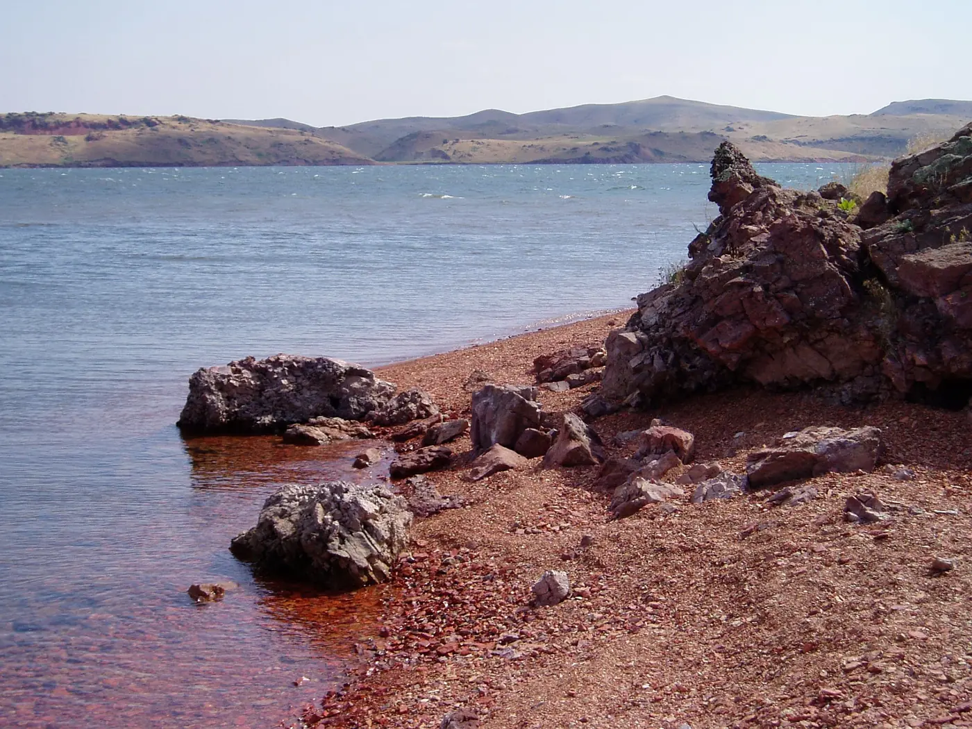
The red rock along the shore is clinker. The lake sits in a basin where the Lake DeSmet coal zone burned naturally long ago, baking the rock above it red. [USGS] The coal under the basin was big enough that Texaco bought the lake property in 1976 to supply water for a coal project. It was never built. [Cowboy State Daily] More on the history page.
Questions
Is Lake DeSmet in Wyoming or South Dakota?
Lake DeSmet is in Johnson County, Wyoming, north of Buffalo. De Smet, South Dakota is a small town in Kingsbury County with lakes of its own. Different place, more than 400 miles east.
How do you spell it: DeSmet, De Smet or Desmet?
All three show up. Johnson County and Game and Fish mostly write Lake DeSmet. Wikipedia uses Lake De Smet. The man it is named for was Father Pierre-Jean De Smet.
Who owns and runs Lake DeSmet?
Johnson County runs the reservoir through its Lake DeSmet Operating Department, created in 2013. Wyoming Game and Fish holds a 99-year lease on part of the stored water that keeps public access open up to the high-water mark.
What exit is Lake DeSmet off I-90?
Exit 51, signed Lake DeSmet. Monument Point boat ramp is reached from Exit 47 by way of Shell Creek Road.
How much water does Lake DeSmet hold?
Johnson County lists the capacity at 234,987 acre-feet. The state water plan notes the lake is not filled above about 213,000 acre-feet because water seeps out through the scoria hills on the north side.
The lake, four times a year
Ice-on and ice-off notes, what Game and Fish is saying about the fishery, events worth the drive and new places to stay. One email a season.